Jessica Wyman
Updated: May 10, 2020
Layer: How It All Began
Capturing existing conditions for 1300+ rooms on pen & paper is a major challenge. Layer founder Zach Soflin knew there had to be a better way. Out of that challenge Layer App was born
What happens when technology makes preservation work easier and more efficient?
When a particularly complex preservation project presented itself, BVH Architecture took a researcher's approach to find a solution to help architects and preservationists. Fusing BIM and manual documentation through technology created newfound ease and efficiency that led to better results.
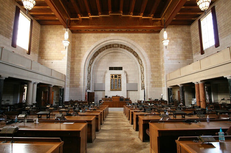
The Nebraska State Capitol is the most recognizable building in the state of Nebraska, drawing as many as 100,000 visitors a year. Its design is the result of a nationwide competition won by American architect, Bertram Goodhue, in 1920. The building was the nation's first statehouse design to radically depart from the prototypical classical form of the United States Capitol. Constructed in four phases from 1922-1932, the building was completed just under the $10 million budget.

Nebraska State Capitol, Lincoln, NE designed by Bertram Goodhue, 1922-1932
The Capitol is now undergoing an eight-year phased interior rehabilitation and HVAC replacement project. The historic steel windows will be preserved while integrating new MEP systems.
The project is large and complex, covering approximately 600,000 square feet of conditioned space. One of the first tasks of the design phase included fieldwork, investigation, and a detailed survey of each of the 1,365 rooms and 1,191 windows. The scale and multiplicity of solutions for this project necessitated a different approach to the collection, coordination, and design of solutions. After running through the available options, our team at BVH decided that there must be a technological solution that would help us gather and organize this data while also tying it to BIM.
We started researching to find out what tools could help us. However, we quickly learned that while there were many apps that addressed different parts and pieces of what we needed, we found no single solution. Next, we decided to take a new approach and looked to the programming and computer science industry and how they work. At the core of nearly all technology development is open-source software and libraries. These collections of code do specific things and are kept inherently general so they can be as adaptable as possible. These libraries are free for anyone to use. They are developed by tens to sometimes thousands of people contributing pieces of code in an organized manner to improve its purpose. The benefit is that instead of recreating the wheel each and every time a new piece of software is built, these libraries can be plugged into a software program, performing their specific task.
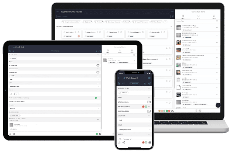
The initial problem of organizing and analyzing the reams of available data was solved by leveraging these open-source libraries and technological advancements to build a solution in-house. The result is a multi-platform application with the ability to layer contextual data on top of an already detailed BIM model. Specifically, it allows the team to collect information in the field on tablet PCs, iPads, and other portable devices, and immediately tie that information to specific model elements, like rooms, windows, and doors. The users are able to adapt the data required specifically to their individual project, tailoring to character-defining features and building elements that need to be assessed, documented, and evaluated in the field.

The Nebraska State Capitol project required our team to collect 57 data points in each room
When working in BIM, the team has instant access to all information collected via a dashboard that shows the related information as the user navigates through the model. Not only does this dashboard allow users to view and edit data that was collected, but the team can also add tasks and communicate with messaging in the context of specific elements like rooms, windows, and doors. This makes tracking progress and design of each of these solutions much easier to coordinate.

Layer is compatible on almost every device or browser and integrates directly with Revit as an add-in
This application has since evolved into the Layer app. The app has the ability to layer contextual data on top of the existing model in BIM, organizing and curating all of the information gathered during the assessment and documentation process. Perhaps most importantly of all, the app is adaptable in the field, allowing for individual and unique parameter additions and revisions in real-time. Layer integrates with Revit, allowing it to link directly to BIM and allows for the parameters housed within each digital tool to be readily accessed.

Layer is designed for users to capture building information in the field and for team members back at the office to view that data instantly in BIM.
As the project progressed, so has Layer. We added more features and tools until it became something that not only worked for this one project, but could be adapted to any project - new construction, historic preservation, or renovation. Layer quickly became an invaluable BIM integration to allow the project design team to leverage digital technology at a historic, iconic building during complex, major rehabilitation and preservation campaigns.
This article was originally published in the APT International BIM Newsletter.


