How a National Planning & Design Firm Streamlined their Assessment of a University Campus
“Layer has been invaluable for collecting quantitative and qualitative data”
Eric Schappe Director of Technology
The Challenge: Conducting Surveys the Analog Way
Universities conduct existing conditions studies before embarking on a renovation, expansion, or demolition. A university hired Flad Architects to evaluate one of their campuses to justify and inform a strategic roadmap for future projects.
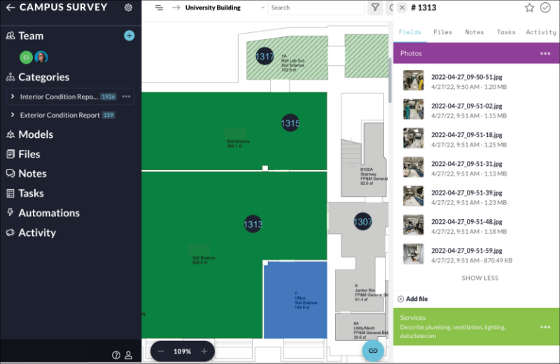
Starting a new existing conditions assessment is no easy feat. Especially one that involves 31 buildings. One can imagine how overwhelming collecting data for hundreds of thousands of square feet might be. Especially without a system in place.
“We were still using some antiquated ways to document info,” explains Jamie Matthys, Director of Strategic Planning. “For example, one person might use a clipboard and paper notes while someone else took photos on their iPhone. And there is a lot of effort in connecting the high-tech and low-tech data after the fact.”
Having conducted several large scale site evaluation surveys, the Flad team was ready to streamline this process for good.
The Solution: Digitizing their Building Assessment Workflow
Flad’s scope extended beyond snapping photos of the existing buildings. They collected quantitative and qualitative data. They conducted user experience interviews with building facilities and department managers. They learned about the history of the spaces they were surveying.
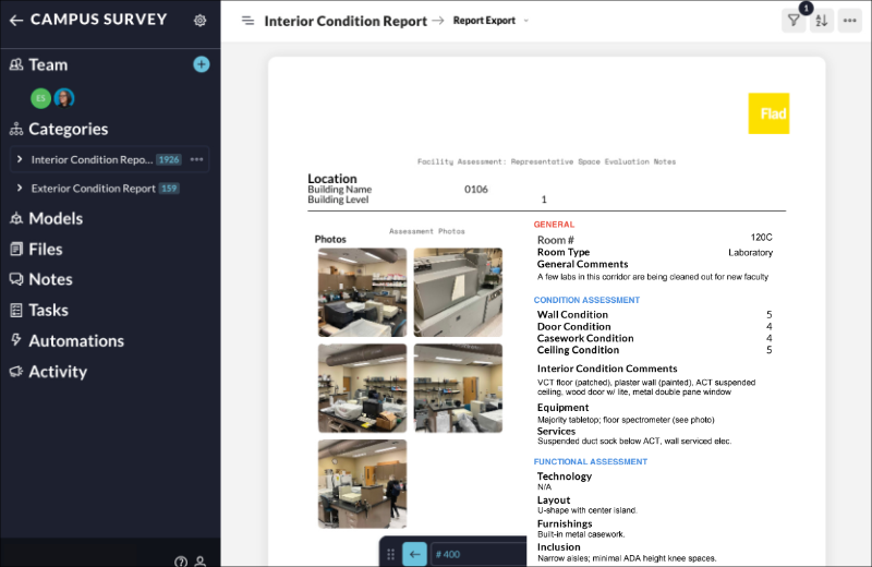
And, they were able to store all this data in their Layer project.
“The UI is very intuitive. Layer was easy to set up and adopt by our teams.” – Eric Schappe, Director of Technology.
Minimizing time spent on learning new software was key for the Flad team. They prioritized their efforts on understanding the campus’ existing assets. This is where their value as architectural and planning professionals lie.
Layer became a structured way for the team to collect data at the same time on site. The team executed the walkthroughs over the course of several months. Being able to continuously add and reference data within their Layer project from an iPad and computers was a life saver.
Gone are the days of translating written text to a spreadsheet and manually dragging photos from an iPhone folder to the server. Layer connected these disparate data points together organized by location, across a multidisciplinary team, enabling the Flad team to tell a story with their data.
“Layer was invaluable to this process. The tool allowed us to collect and connect info real time. We didn’t have to spend time organizing and post-processing the data to get it to a usable format in one location.” The data became a critical piece of justification to reference and support project recommendations,” states Matthys.
The project is ongoing, and the team continues to use Layer to support current efforts and explore additional use cases.